One of the standout applications for travel of any kind is Google Maps, worldwide, users choose to use this platform to view maps of any area and find relevant information. That’s why maps have become one of the most used tools on mobile devices. Thus, Google Maps offers its assistance to millions of people every day to find a specific location at a given moment.
If you want to learn how to use Google Maps to get home from a specific location, we invite you to read this post carefully. In this way, you will be able to make the most of this app from the tech giant.

All the steps to use Google Maps to get home from a specific location:
If you want to know how to use Google Maps to get home from a specific location, here are all the steps to follow in detail:
Step 1: Open Google Maps on the device of your choice
First, you need to open Maps on the device you want to use. So, whether through the mobile app or from your preferred web browser, search and enter Google Maps with your mobile device or tablet.
Step 2: Enter the address or search for the place / business
In the search bar, you have to enter the address or the name of the location from which you want to get home. Alternatively, you can select it specifically on the map.
Step 3: Tap the search button
Once you have entered the location, press the search button. Google Maps will show you the location on the map, and you will be given the option to get directions.
Step 4: Click on “Get directions”
Next, it’s time to click on the button that says “Get directions,” and after that, enter your home address in the destination field or ‘Home’ if you have already saved it.
Step 5: Find the fastest route
After that, Google Maps will calculate the fastest route or the recommended route to get home from the location you entered. By default, the platform presents the best way to get to your home and take the least amount of time.
Step 6: Get route details
Once the directions are displayed, you can review the route on the map and see the available details. Whether it’s the distance, estimated arrival time (ETA), and step-by-step instructions.
Step 7: Click on “Start”
If you are satisfied with the route, just press the “Start” button to begin step-by-step navigation to your home. Indeed, follow all voice instructions and on-screen instructions as you travel safely and quickly to your home.
How to measure distances on Google Maps for Android?
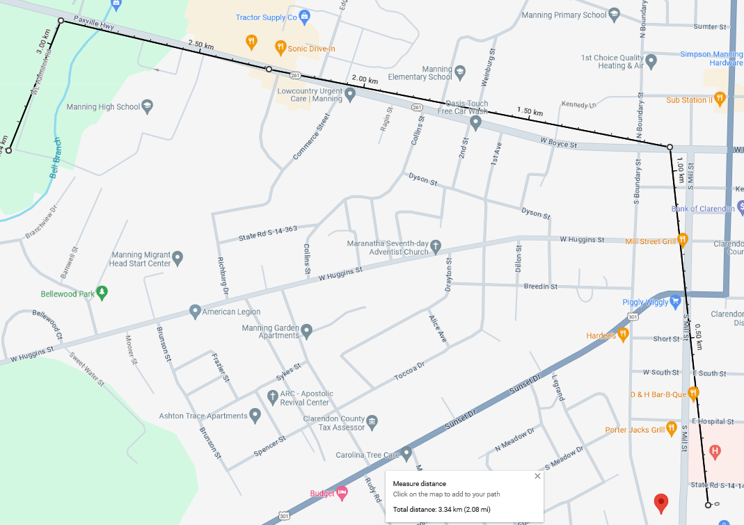
You may not know it yet, but if you are an Android user, you have the ability to measure distances easily through Google Maps. To do this, follow these steps:
- First, open the Google Maps application on your Android device, whether it’s your smartphone or tablet.
- Next, press and hold your finger on the point on the map from which you want to start measuring the distance. A marker will appear, and a popup window will open at the bottom of the screen.
- In the popup window, tap on the “Measure distance” option in the menu.
- Now, move the map and tap on the points where you want to measure the distance.
- Once done, a line will be drawn between the points, and the total measured distance will be displayed at the bottom of the screen.
- If you need to add more points to measure a more complex route, simply tap on the new points, and the total distance will be updated automatically.
- Finally, when you have measured the distance you need, you can save the measurement by tapping the “Save” button in the popup window.
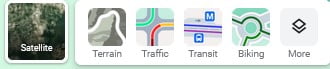
How to view Google Maps with 3D satellite view on Android?
The satellite view of Google Maps is a feature that allows users to see real images of the Earth taken from satellites in space. This view provides a detailed visual representation of the Earth’s surface, including cities, landscapes, bodies of water, roads, buildings, and other geographical elements.
- To start, access the Google Maps application on your Android device.
- It’s time to search for the location you would like to see in 3D satellite view. You can do this using the search bar at the top of the screen.
- Once you have found the location, perform a pinch gesture with two fingers on the screen to zoom in or out of the map, as needed.
- Next, tap the icon in the bottom right corner of the screen that resembles a mountain. This will activate the 3D satellite view.
- Now, you can view the location in 3D satellite view.
- If you want to explore the area, drag with one finger to change the perspective and get different viewing angles.
- Finally, to return to the standard map view, simply tap the mountain icon again in the bottom right corner.
How to use Google Maps offline on Android?
On Android devices, it is possible to access maps and directions offline, as you can use Google Maps without an internet connection. To do this, the procedure is as follows:
- Open the Google Maps application on your Android device.
- Make sure you have an active internet connection before starting this process.
- Now, search for the location or area you would like to save for offline use. For example, you can search for a city, an urban area, or a specific region; whatever you need.
- When you have found the location, tap on the search bar to view detailed information about the location.
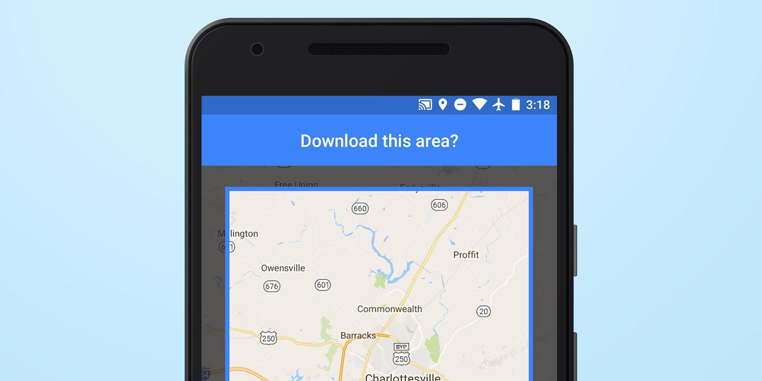
- Next, scroll down in the detailed location information and look for the option that says “Download offline map.”
- Subsequently, press “Download offline map” and adjust the map area you want to save. Note that you can adjust the area by moving and zooming in on the map.
- After choosing the area, tap the “Download” or “Save” button to save the offline map to your device.
- Finally, when the map has been downloaded, you can access it without an internet connection. To do this, simply open the Google Maps application and access the area you downloaded. The map will be available for use even if you don’t have an internet connection.